Trail Walking Val de Bagnes - Cabane de Louvie – Cabane de Prafleuri / Jour 3 - Photo

Cabane de Louvie – Cabane de Prafleuri / Jour 3

 Greg813
Greg813

User

© OpenStreetMap contributors
Length
Length
11.8 km
Max alt
Max alt
2989 m
Uphill gradient
Uphill gradient
1076 m
Km-Effort
Km-Effort  
25 km
Min alt
Min alt
2204 m
Downhill gradient
Downhill gradient
656 m
Boucle
Boucle
No
Creation date :
2023-08-09 06:11:24.924
Updated on :
2023-10-01 15:14:41.911

(0 Reviews)

Walking
Walking
4h54
Difficulty : Difficult

Scan this QR Code to open this trail in the SityTrail application

FREE GPS app for hiking

Logo SityTrail SityTrail

IGN / Geographical institutes

Download SityTrail from the App Store Download SityTrail from Google Play

Logo SityTrail SityTrail World

The world is yours!

Download SityTrail from the App Store Download SityTrail from Google Play Download SityTrail on Huawei AppGallery

About

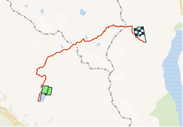
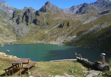
Trail Walking of 11.8 km to be discovered at Valais/Wallis, Entremont, Val de Bagnes. This trail is proposed by Greg813.

Description

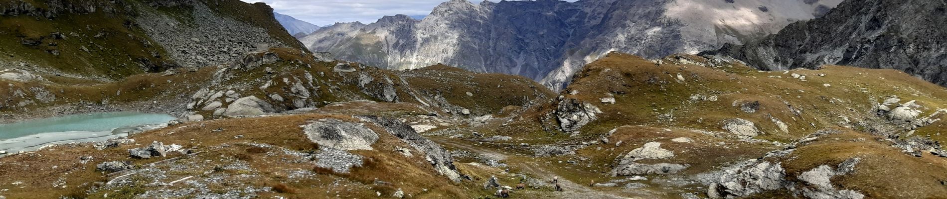
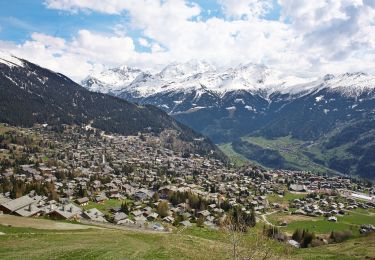
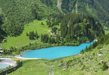
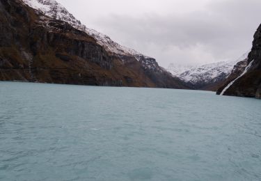
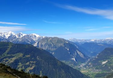
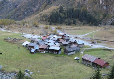
Trek de 10 jours dans le Valais suisse avec Mettons le Monde en Marche. Parcours de la Haute Route Chamonix-Zermatt avec nuits en refuge.

Etape 2 : Cabane de Louvie – Cabane de Prafleuri

Pour d'autres photos, voir le site de l'association :
https://mmm-rando.org/la-presque-haute-route-chable-zermatt/

Elevation profile

Photos

Points of interest

Point of interest Val de Bagnes - Cabane de Louvie - Photo
Greg813
VAL DE BAGNES 
Point of interest Hérémence - Cabane de Prafleuri - Photo
Greg813
HÉRÉMENCE 

Positioning

Country:
Switzerland
Region :
Valais/Wallis
Department/Province :
Entremont
Municipality :
Val de Bagnes
Location:
Unknown
Start:(UTM)
368986 ; 5100684 (32T) N.

Trails nearby

Trail On foot Val de Bagnes - Ancien Bisse du Levron - Photo
On foot
PRO

On foot

Easy
Val de Bagnes, Valais/Wallis, Entremont, Switzerland
10.7 km | 13.4 km-effort
3h 2min
No
Trail On foot Val de Bagnes - Fionnay-Bonatchiesse - Photo
On foot
PRO

On foot

Easy
Val de Bagnes, Valais/Wallis, Entremont, Switzerland
4.5 km | 6.3 km-effort
1h 26min
No
Trail On foot Val de Bagnes - Louvie-Fionnay - Photo
On foot
PRO

On foot

Easy
Val de Bagnes, Valais/Wallis, Entremont, Switzerland
3.7 km | 6.3 km-effort
1h 26min
No
Trail On foot Val de Bagnes - Col Termin-Louvie - Photo
On foot
PRO

On foot

Easy
Val de Bagnes, Valais/Wallis, Entremont, Switzerland
3.8 km | 6.3 km-effort
1h 25min
No
Trail Walking Val de Bagnes - Mauvoisin Bonatchiesse - Photo
Walking
michauxpaul

Walking

Difficult
Val de Bagnes, Valais/Wallis, Entremont, Switzerland
8.7 km | 16.2 km-effort
3h 40min
Yes
Trail Walking Val de Bagnes - Le Châble – Cabane de Louvie / Jour 2 - Photo
Walking
Greg813

Walking

Difficult
Val de Bagnes, Valais/Wallis, Entremont, Switzerland
12.4 km | 21 km-effort
3h 37min
No
Trail On foot Val de Bagnes - Promenade de la Dranse - Photo
On foot
PRO

On foot

Easy
Val de Bagnes, Valais/Wallis, Entremont, Switzerland
7.1 km | 9.4 km-effort
2h 8min
No
Trail On foot Val de Bagnes - Bonatchiesse-Mauvoisin - Photo
On foot
PRO

On foot

Easy
Val de Bagnes, Valais/Wallis, Entremont, Switzerland
3.2 km | 6.1 km-effort
1h 22min
No
Trail Walking Val de Bagnes - CHX ZRMT Étape 4 de Cabane de Louvie à Cabane de Prafleuri - Photo
Walking
jeff2

Walking

Medium
Val de Bagnes, Valais/Wallis, Entremont, Switzerland
12.3 km | 25 km-effort
5h 28min
No


Close
My subscriptions